Friday, July 1, 2022

PCT Day 48

     <--PREVIOUS                                                                                                           NEXT--> 

PCT Day 48, 29 June 2022 (Wednesday)

"On The Way To Lake Edison, A Light Bulb Switched On"


Start Location:

Wilderness Campsite Before VVR Trail Junction

Destination:

Vermillion Valley Resort (VVR)

PCT Miles Day 48:

6.5

Cum PCT Miles:

878.7

Non-PCT Miles Day 48:

8.5

Cum All Miles:

956.3

PCT Miles Remaining:

1,773.9


Elevation Gain Day 48:

970

Cum Elevation Gain:

156,704


Vermilion Valley Resort (VVR) is located at Lake Thomas A. Edison.  It’s a fairly large man-made lake located south of Mammoth Lakes and west of Round Valley.  It’s pretty popular with PCT and JMT hikers as they are very hiker friendly.

There are multiple options on how to get here, so you really have to think about what works best for you.  The Bear Ridge Trail is by far the most popular option, and is promoted by VVR as the best option, probably because it’s the fastest way for northbound hikers to get there.

However, it’s a 2,000 foot descent from the PCT down the Bear Ridge Trail to the resort; this is all on a side trail, meaning that to have a continuous footpath for a true thru hike, you have to go back up those same 2,000 feet over 5 miles to rejoin the PCT where you left it.

Alternately, you can travel another 4.2 miles down the PCT, which also includes the 2,000 foot decent.  Then it’s another 6.5 miles on the Lake Trail, also a side trail, to get to VVR.  But, this means you don’t have to go back up those 2,000 feet to get back to the PCT.  There is also the option to catch a ferry in the morning that eliminates much of the 6.5 mile hike back on the side trail.  Overall, going this way is a longer distance, but saves a lot of climbing back up hill.

When I got to the Bear Ridge Trail junction, I started going down, but then stopped to think whether that was really the best option.  After looking at the mileage and elevation profile, I decided going via the Lake Trail was really the better option.  It was like a light bulb going off.  Though it did take longer to get there, everything worked out great.  I got to VVR in plenty of time to do everything I wanted to do.

They are serving a BBQ meal here tonight, should be better than my normal hiker dinner.


BTW, as an indication of the dirt bag hiker I've become, when I got to VVR it'd been six days since I'd had a shower.   You can pay for a shower at VVR, but I thought naw, it's only two more days until I get to Mammoth.   If it's already been six days, what's two more days?


Seven Gables peak on the way to VVR
 
 
    <--PREVIOUS                                                                                                             NEXT--> 


PCT Day 47

     <--PREVIOUS                                                                                                          NEXT--> 

PCT Day 47, 28 June 2022 (Tuesday)

"Selden Seen"


Start Location:

Wilderness Campsite Past Evolution Creek

Destination:

Wilderness Campsite Before VVR Trail Junction

PCT Miles Day 47:

19.9

Cum PCT Miles:

872.2

Non-PCT Miles Day 47:

0.8

Cum All Miles:

941.3

PCT Miles Remaining:

1,780.4


Elevation Gain Day 47:

3,411

Cum Elevation Gain:

155,734


After the super spectacular scenery the last several days, it was hard to get excited about the scenery the first 12 miles today.  It was pleasant, but it just didn’t compare. But starting at Sallie Keyes Lake everything got much better.

There were three main things I had in mind today.  One, getting a fair number of miles in so I could get close to Vermillion Valley Resort (VVR); I plan on doing a mini resupply there, getting some fresh meals, and spending a night there.  Two, going over another high pass, Selden Pass.  And three, another significant creek crossing, Bear Creek.

I did get in almost 20 miles, which is good.  I could have gotten in a few more, but saw a good tent site by Bear Creek, so decided to stop at that point.

Selden Pass at 10,913 ft. is below tree level so it has a very different look than the passes that are about 1,000 feet or more higher.  I didn’t know what to expect of this pass, so I was pleasantly surprised.  It was just as scenic as the other high passes, but in its own way.  None of the high passes have disappointed yet.

As for Bear Creek, it was tamer than yesterday’s Evolution Creek.  The water was no more than knee-high and the current was not very strong, at least not where the crossing was.  Bear Creek, like Evolution Creek, can be dangerous to cross when water levels are high.  But right now, it’s a pretty simple crossing.


South Fork San Joaquin River in the morning

Piute Creek Bridge, the border of Kings Canyon N.P. and John Muir Wilderness

Sallie Keyes Lake

Outlet from Heart Lake on the way to Selden Pass

Selden Pass trail

Heart Lake from atop Selden Pass

Looking north from atop Selden Pass

Marie Lake

Bear Creek, second legs wet crossing

Bear Creek near sunset
 
  <--PREVIOUS                                                                                                             NEXT--> 

PCT Day 46

    <--PREVIOUS                                                                                                             NEXT--> 

PCT Day 46, 27 June 2022 (Monday)

"But Wait, There's Muir"


Start Location:

Wilderness Campsite Near Middle Fork Kings River

Destination:

Wilderness Campsite Past Evolution Creek

PCT Miles Day 46:

21.8

Cum PCT Miles:

852.3

Non-PCT Miles Day 46:

0.5

Cum All Miles:

920.6

PCT Miles Remaining:

1,800.3


Elevation Gain Day 46:

3,886

Cum Elevation Gain:

152,323


Today probably had the most adventure yet out here on the PCT.  First was hiking up and out of the Kings River canyon.  It seemed like every time you got another look at the river, it just got more scenic. But the whole day was like that.

Next, was a much harder than expected hike up to Muir Pass, another high pass at 11,970 feet.  What made it hard was that it had much more snow than any pass yet.  Between the snow and a lot of rocky sections, the trail was a bit hard to follow at times.  Also, some of the snow sections were quite sketchy.

The snow was getting soft, and I was post-holing regularly.  The danger was that the snow is melting from underneath and when you stepped thru, you didn’t know how far it was to the bottom.  It was basically snow bridges.  What I had to do was poke the snow in front of me with my trekking pole, and if it was firm then I could go forward, and if the pole just kept going down, then I had to find another place to step.  I didn't take any pictures in these really sketchy areas because I was afraid I'd drop my phone in the snow and lose it.

It was very slow going, and took a lot of effort.  It was the first time on this hike that my legs were beginning to feel a little like Jell-O.  It took six hours to go the first 8.5 miles today; that is an extremely slow pace.  Because of the sketchy snow sections, it was hands-down the hardest pass yet.  With no, or much less snow, it would've been a relatively easy pass to get up.  However, the rewards exceeded the effort.  And while this was the hardest pass going up, it was also the easiest going down.  I guess that’s fair.

Another noteworthy thing today was that there was finally a creek crossing that could not be rock hopped.  Evolution creek is well known to be one of the most difficult and dangerous creek crossings in the Sierra when the water levels are high.  Even though the water level today was not dangerous, it still came up to about mid-thigh, and you could feel the force of the current while crossing.  On the plus side, my shoes, socks, and feet got a good cleaning.

Despite the slow start, I still got a fair number of miles in today, and I’m about 8 miles ahead of my plan.


Whale Rock

Middle Fork Kings River on the way up to Muir Pass

It just keeps getting better, Middle Fork Kings River

Unnamed lake, looks like a large infinity pool from here

More snow crossings on the way to Muir Pass

Some ice still left on Helen Lake, named for one of John Muir's daughters

One last stretch of snow before the top of Muir Pass

Muir Hut at the top of Muir Pass.  It serves as an emergency shelter if you get caught up there in a bad storm.  It's actually roomier on the inside than it looks like from the outside--like the Tardis on Dr. Who--and it has a fireplace.

Lake McDermond and Wanda Lake, looking north from Muir Pass

Wanda Lake

Wanda Lake outlet

First Evolution Creek crossing, this one is just a long rock hop

Evolution Lake

The Hermit

Colby Meadow with Evolution Creek running thru it

Evolution Creek, the first legs wet crossing

Evolution Creek waterfall
 
 
    <--PREVIOUS                                                                                                             NEXT--> 

PCT Day 45

   <--PREVIOUS                                                                                                             NEXT--> 

PCT Day 45, 26 June 2022 (Sunday)

"All That Mathers"


Start Location:

Wilderness Campsite

Destination:

Wilderness Campsite Near Middle Fork Kings River

PCT Miles Day 45:

19.2

Cum PCT Miles:

830.5

Non-PCT Miles Day 45:

0.6

Cum All Miles:

898.3

PCT Miles Remaining:

1,822.1


Elevation Gain Day 45:

2,950

Cum Elevation Gain:

148,437


I’ve been waiting to do today’s hike for quite some time.  Not just to go up Mather Pass, another high pass at 12,094 ft., but because of what was beyond Mather Pass.  Firstly, Upper and Lower Palisade Lakes are supposed to be extremely scenic; and they did not disappoint one bit.  Cell phone pictures really can’t do scenery like that justice.  Even a great photographer with a great camera would be unable to capture the essence of Lower Palisade Lake.  It truly is one of those places you just have to experience in person to know what it's like to be there.

And then beyond that is the famous “Golden Staircase,” the last section of the John Muir Trail (JMT) to be built.  These are the steep switchbacks leading down from Lower Palisade Lake.  I believe it was the last section, because it was in such a difficult area to build a trail.  With Palisade Creek roaring and tumbling in the background all the way down the canyon, this area also was incredibly scenic.  However, I also have to say that it lived up to it's reputation as a knee killer.

Lastly, there was miles of walking along the cascading and sliding Middle Fork Kings River.  I am camped right by it tonight.  I am trying to read Isaac Asimov’s Foundation, not sure how far I’ll get with the river providing great white noise to help with sleep.

Except for the last few miles, much of today's trail was very technical, and thus, very slow.  The trail up to the pass was actually pretty nice, and not that hard.  But, maybe it was because I went up earlier in the day and not later in the day.  The multiple patches of snow coming down Mather Pass were the sketchiest yet.  There were also miles of talus and loose rock.  And although today’s total elevation gain wasn’t extremely large, there was a lot of steepness.  The last few miles of easy, soft trail allowed my knees to mostly recover from the trauma of coming down the Golden Staircase.

One last good thing, I got a break from the rain, at least for today.


Kings River Crossing, by far the biggest crossing yet.  Believe it or not, I didn't get my feet wet

Hiking along the South Fork Kings River in the morning

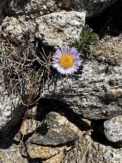
Subalpine Fleabane

Scenery from this morning

South Fork Kings River

Atop Mather Pass looking NW with Palisade Lakes down below

Atop Mather Pass, looking SE

Upper Basin

A lot of seasonal creeks running across the trail in the last couple days

Mather Pass and Upper Palisade Lake

Very Scenic Lower Palisade Lake

There are worse places in the world to walk along today than Lower Palisade Lake

Part of the "Golden Staircase"

Western Wallflower

Palisade Creek tumbling down the canyon

A powerful cascade in the Middle Fork Kings River

Grouse Meadow

Middle Fork Kings River right outside my campsite
 
 
   <--PREVIOUS                                                                                                             NEXT--> 

PCT End Of Hike Summary

<--PREVIOUS PCT End Of Hike Summary "A Summary Of My PCT Thru Section Hike"   This is the hardest post to write.  I could prob...