Friday, September 2, 2022

PCT Day 106

<--PREVIOUS                                                                                                                NEXT--> 

PCT Day 106, 26 August 2022 (Friday)

"Turning Trail"


Start Location:

Six Mile Campsite

Destination:

Methow River

PCT Miles Day 106:

23.5

Cum PCT Miles:

1,961.4

Non-PCT Miles Day 106:

1.3

Cum All Miles:

2074.8

PCT Miles Remaining:

691.4


Elevation Gain Day 106:

4,755

Cum Elevation Gain:

345,577

 
Today was the first day in Washington where the trail was pretty good all day long.  The first few miles were still in the national park, so I expected that part of the trail to be good.  That trail also had signs of recent maintenance, something you don’t see on the national forest trail.

I was worried after leaving the national park and reentering the national forest that things would quickly go bad.  However, while there were a few areas needing some work, overall the trail was really pretty good all day.  If all of Washington was like today, I would be a very happy hiker.  The trails in this area are very popular with the locals, so I’m sure that has something to do with the good condition of the trail in this area.

Even with the good trail, the hiking today was hard as usual in Washington.  However, there were a lot of good views of the north cascades, so this is the kind of hard hiking that is worthwhile.  I am now only 46 miles from Canada, and will hopefully be there on Sunday.


What it looks like when an actual effort is made to maintain the trail and beat back the bushes. Of course, this is in the national park, not the national forest.


Yep, this is National Forest Service trail, that didn't take long after leaving the national park.


Log bridge over Rainy Lake outlet


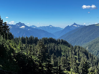
North Cascades while approaching Cutthroat Pass
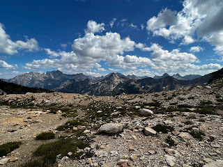


More North Cascades from Cutthroat Pass


More North Cascades


<--PREVIOUS                                                                                                            NEXT--> 


PCT Day 105

<--PREVIOUS                                                                                                            NEXT--> 

PCT Day 105, 25 August 2022 (Thursday)

"Night And Day"


Start Location:

Stehekin

Destination:

Six Mile Campsite

PCT Miles Day 105:

11.2

Cum PCT Miles:

1,937.9

Non-PCT Miles Day 105:

1.8

Cum All Miles:

2050.0

PCT Miles Remaining:

714.9


Elevation Gain Day 105:

2,818

Cum Elevation Gain:

340,822

 
I thought about taking a zero day in Stehekin today, but was only going to do so if I could get a room at one of the two resorts here.  Since everything was fully booked, it was a pretty easy decision to get back on the trail this afternoon.  I actually ended up getting everything done I wanted:  I took a shower, I did my laundry, I picked up a couple resupply boxes at the post office, got all my resupply food organized and packed up, and I went to the Stehekin Pastry Co.

My timing was good, because just when I was done at the bakery, I was able to catch the shuttle back up to High Bridge.  I was back on the trail at 2:15pm.  Because of North Cascades National Park restrictions, I was going to have to make a choice between two campsites tonight. The first one is at Bridge Creek which is five miles up the trail.  The second is Six Mile Camp, which is 11 miles up the trail.  There was going to be a steady, steep uphill climb today, so I wasn’t sure where I’d stop, especially since my pack was, once again, heavy with food.

Even with the relentless uphill climb, I was making good time.  So, I decided to go to Six Mile Camp.  This will, hopefully, put me in good position to get to the Canadian border in three more days.  It is only 69 miles away.

One of the reasons I was making good time today is that I was hiking on good, well maintained trail.  This trail is maintained by the National Park Service (NPS), not the National Forest Service (NFS).  The NPS puts a much higher priority on good trails than does the NFS.  In Washington, it’s a very stark difference.  It’s really like night and day.  Too bad the NPS doesn’t oversee the entire PCT; if they did, the experience of hiking the PCT in Washington would be vastly better.


The famous Stehekin Pastry Company


Hmm, I wonder if my shoes should be longer


Slatted suspension bridge over Bridge Creek, the sketchiest bridge I've ever crossed over


<--PREVIOUS                                                                                                            NEXT--> 
 

PCT Day 104

<--PREVIOUS                                                                                                            NEXT--> 

PCT Day 104, 24 August 2022 (Wednesday)

"Last Stop Before Canada"


Start Location:

Wilderness Campsite

Destination:

Stehekin

PCT Miles Day 104:

19.5

Cum PCT Miles:

1,926.7

Non-PCT Miles Day 104:

0.6

Cum All Miles:

2037.0

PCT Miles Remaining:

726.1


Elevation Gain Day 104:

1,509

Cum Elevation Gain:

338,004

 
I got up early, and as expected, my tent and ground cloth were soaking wet from the condensation.  Well there’s really nothing to do but to pack it up wet and then dry it out later in the day when the sun is out.  Though taking everything out to dry in the middle of the day takes time away from hiking, it’s really a very necessary thing to do.

Today was supposed to be a fairly easy 20 mile hike down to High Bridge.  From High Bridge, almost all hikers will catch a ride, or take a shuttle bus down to Stehekin on Lake Chelan, the largest natural lake in Washington.  The first few miles were slower than I had hoped.  But after that, the trail was fairly fast, despite the usual Washington trail issues.

As I descended the trail towards Stehekin, it was noticeable that the temperature was increasing.  It was close to 100° down at lake level.

Stehekin, which is ~80 miles from the Northern Terminus at the Canadian border, is an important stopping point for hikers.  Most hikers will send their final resupply box here, get their electronics charged, and get some goodies at the famous Stehekin Pastry Company.  Oddly, the bakery is about 1.5 miles from the main part of town, so I didn’t get a chance to get there today.  I will have a busy day tomorrow, and getting to the bakery is on the to-do list.


The northwest end of Lake Chelan, the largest natural lake in Washington


More Lake Chelan


<--PREVIOUS                                                                                                            NEXT--> 


PCT Day 103

 <--PREVIOUS                                                                                                            NEXT--> 

PCT Day 103, 23 August 2022 (Tuesday)

"You Want To Get To Canada, You Have To Come Through Me First"


Start Location:

Wilderness Campsite

Destination:

Wilderness Campsite

PCT Miles Day 103:

23.6

Cum PCT Miles:

1,907.2

Non-PCT Miles Day 103:

0.3

Cum All Miles:

2016.9

PCT Miles Remaining:

745.6


Elevation Gain Day 103:

4,806

Cum Elevation Gain:

336,495


Today was so Washington.  The first 10 miles were a continuation of yesterdays brutal trail.  These should have been fast miles, but they were slow miles due to the trail conditions.  My per mile pace, if the trail had been good, would’ve been under 20 minutes per mile, instead it was just under 30.

But then things changed, they actually got better.  The trail got wider, there was no overgrowth, there were less obstacles, it was actually good hiking.  But, this being Washington, the good times never last.

For the first time in almost three weeks, there was real rain from an afternoon thunderstorm.  And, just because Washington likes to be a jerk, the trail got narrower and the overgrowth came back.  So, even after the rain stopped, you continued to get wet from all the water on the vegetation that you were brushing up against.  Washington is never satisfied with one level of misery, it loves to layer it on.

My pants, shoes, socks, and feet were soaking wet by the time I stopped to camp.  It was pretty miserable.  There was no point putting on rain pants, because they would simply have gotten shredded by all the obstacles and overgrown vegetation.  Good thing, though, I stopped in the middle of the day to dry all my sleeping gear out.  So, everything I sleep in was at least dry to start the evening.  I know everything is going to be soaking wet again in the morning from the condensation, and I will have to dry it out again tomorrow afternoon.

The guy I camped next to is a native of Washington, and has hiked in Washington for decades.  He said the PCT in Washington is the worst he’s ever seen.  In fact, he apologizes to all PCT hikers he meets for the condition of the trail, especially the internationals, because of all the money they spend to be here.  He also brought up a good point.  He said that if they don’t do anything soon, the trail will be unhikeable in a year or two.  The vegetation will be so thickly overgrown, it will simply be impassible.

If misery is humorous, than the last three weeks should have been hilarious.


A great morning view of Glacier Peak


Just one of the dozens of similar glacier fed streams to cross this morning


This is not even single track trail, it is half-track trail. Because the trail is in a U-shaped channel, you can barely even move one foot in front of the other.


This is not ideal, but more acceptable


Seriously?


Fancy bridge over the Suiattle River


And it's a good thing there's a bridge over Suiattle River as it would be very dangerous to cross


Miners Creek


Am I daydreaming, or is this trail in Washington? Guess I'm not daydreaming, there is another obstacle ahead.


Washington trail at its finest


 <--PREVIOUS                                                                                                            NEXT--> 


PCT Day 102

 <--PREVIOUS                                                                                                            NEXT--> 

PCT Day 102, 22 August 2022 (Monday)

"Top Ten To Bottom Ten"


Start Location:

Wilderness Campsite

Destination:

Wilderness Campsite

PCT Miles Day 102:

23.4

Cum PCT Miles:

1,883.6

Non-PCT Miles Day 102:

1.0

Cum All Miles:

1993.0

PCT Miles Remaining:

769.2


Elevation Gain Day 102:

6,042

Cum Elevation Gain:

331,689

 
Today was so frustrating.  There was so much great scenery, this part of trail should be one of the top 10 sections on the PCT.  But because of all the serious deficiencies in the trail itself, this section, in my opinion, is in the bottom 10.

I don’t understand what is going on with the PCT in Washington. I mean, it’s like the trail in many spots has been totally abandoned.  About half the trail today was actually good to OK.  But the other half was just horrendously bad.  It’s so bad, that parts of it are just plain old hazardous, and even dangerous.  I can’t even count how many times today one of my eyes almost got taken out by overgrown vegetation.  I didn’t realize that safety goggles should be on the packing list of a PCT Hiker.

The steepness of this trail makes it inherently hard.  However, the absolute neglect of the trail just magnifies the difficulty.  But worse, it makes it infuriating and demoralizing just to try to hike it.  As I’ve said before about Washington, this is not backpacking, this is a jungle expedition.  It’s really too bad that such a stunningly scenic area is leaving visitors with such strong negative feelings instead of positive feelings.  Compare this to the Southern Sierra Nevada where the trail does not detract from the scenery.

On the plus side, I was able to dry out all my sleeping gear during a long break in the sun.  So, at least everything will be dry for one day.  And today also had what was probably the most difficult water crossing of the hike yet at Kennedy Creek.  This was one water crossing you had to take seriously.


White Chuck River

More White Chuck River

Broken bridge over Baekos Creek, still good enough to cross


The challenging Kennedy Creek crossing

My drying and snack stop, at least I had a nice view while I waited for my sleeping gear to dry out

Pumice Creek


Getting close to Glacier Peak

Just one example of the dozens and dozens of obstacles to get by on this trail

Are the views worth the effort?


Fire Creek

Glacier Peak Wilderness panorama

More Glacier Peak Wilderness


Mica Lake

Backside of Glacier Peak

 <--PREVIOUS                                                                                                           NEXT--> 


PCT End Of Hike Summary

<--PREVIOUS PCT End Of Hike Summary "A Summary Of My PCT Thru Section Hike"   This is the hardest post to write.  I could prob...