Monday, July 18, 2022

PCT Day 67

<--PREVIOUS                                                                                                             NEXT--> 

PCT Day 67, 18 July 2022 (Monday)

"Bye High Sierra"


Start Location:

Wilderness Campsite Past Mules Ear Creek

Destination:

Sierra City

PCT Miles Day 67:

10.7

Cum PCT Miles:

1,195.4

Non-PCT Miles Day 67:

1.8

Cum All Miles:

1284.5

PCT Miles Remaining:

1,457.2


Elevation Gain Day 67:

872

Cum Elevation Gain:

212,285


It still feels a little weird to call an almost eleven mile hike short (plus another 1.8 miles to get to town and to the place I'm staying), but relative to most days on the PCT, it is.  Good thing, too, because the next best thing to a zero day is a nero day.  And the next best thing after that is what I call a "mero" day, which is what today was (too long to be a nero, but still relatively short).  The eleven miles went pretty quickly and I was in town by noon.

I went straight to the General Store hoping I'd beat most other hikers there before they raided it of items good for packing out.  Unfortunately, the store was already out of many items, and it wasn't the greatest place for even a mini-resupply.  Post-COVID, small stores are having a hard time getting deliveries in these small towns.  None-the-less, you learn to make do out here and buy what you need, not always what you want.  The good thing about doing a resupply at a small store vs. a large supermarket, is that you spend much less time browsing around shopping for things to buy.

I am spending the night at the Sierra Pines Resort, which is a pretty decent place--except lack of air conditioning, which isn't unusual for places like this--with a very friendly staff.  It is situated with the North Yuba River running right below the property.  Surprisingly, they have a Windows PC in the lobby, and that's always a plus as it makes it much easier to update the blog.  I think the management at these inns are always happy to see a guest finally using the guest computer.

Sierra City marks the end of the “High Sierra.” As expected, much of this section was pretty spectacular and scenic. Not everything left to go on the PCT is going to be like this, but we’ll see what’s to come.


Haypress Creek

North Yuba River

Sierra Pines Resort
 
<--PREVIOUS                                                                                                             NEXT--> 

PCT Day 66

 <--PREVIOUS                                                                                                             NEXT--> 

PCT Day 66, 17 July 2022 (Sunday)

"The PCCT"


Start Location:

Near Peter Grubb Hut in Donner Pass Area

Destination:

Wilderness Campsite Past Mules Ear Creek

PCT Miles Day 66:

24.0

Cum PCT Miles:

1,184.7

Non-PCT Miles Day 66:

0.5

Cum All Miles:

1,272.0

PCT Miles Remaining:

1,467.9


Elevation Gain Day 66:

3,388

Cum Elevation Gain:

211,413


Today the trail was so different than yesterday, though the scenery off the trail was very similar.  The trail was mostly soft and even, which made it easy to cruise on.  In fact, an appropriate name for this part of the trail might be the Pacific Cruise Control Trail.

Other than the nice trail, there was virtually nothing notable about today.  In fact, because I was able to hike so easily, I barely remember much of the day because I was just mindlessly moving along in a hiker zone.

I could have, and would liked to have, hiked a few more miles today, but, the last week or so it's been more challenging to find a tent site.  So, when I found a good tent site after doing an acceptable number of miles, I decided to stop and not take a chance on finding a site further up the trail.

Tomorrow, I have a relatively short day to get to Sierra City, where I will do a mini resupply and spend the night.


White Rock Creek

Scenery from the trail

Typical trail today


Pass Creek, a good place for drinking water and feet washing

 <--PREVIOUS                                                                                                             NEXT--> 

PCT Day 65

<--PREVIOUS                                                                                                             NEXT--> 

PCT Day 65, 16 July 2022 (Saturday)

"Lift Off"


Start Location:

Wilderness Campsite Near American River Headwaters

Destination:

Near Peter Grubb Hut in Donner Pass Area

PCT Miles Day 65:

21.7

Cum PCT Miles:

1,160.7

Non-PCT Miles Day 65:

1.0

Cum All Miles:

1247.5

PCT Miles Remaining:

1,491.9


Elevation Gain Day 65:

4,175

Cum Elevation Gain:

208,025


Between yesterday and today, the PCT in this area is like a tour of North Tahoe ski areas.  I have hiked through Alpine Meadows, Palisades at Tahoe, Sugarbowl, and Donner Ski Ranch.  In some cases, the PCT goes right under chair lifts.

I had lunch at Donner Ski Ranch.  The food was just OK, but it’s always nice to get some cold drinks and a new Gatorade.

The only other notable thing today was hiking through the Donner Pass area; I’m sure everyone is familiar with that story.

The trail was pretty rocky and tricky today, so I was glad when the day was done.


It doesn't look like much, but this is the headwaters of the American River.

Palisades At Tahoe (formally known as Squaw Valley) ski lifts.  The trail goes right under the lift.

Hwy 40 and Lake Angela, a popular recreational lake, near Donner Ski Ranch.  It must look strange to drivers to see people walking up here above the highway.


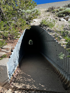
Tunnel under I-80.

I am so hungry, I could eat almost anything (what, too soon?).

Peter Grubb Hut (it's been closed since COVID).
 
<--PREVIOUS                                                                                                             NEXT--> 

PCT Day 64

 <--PREVIOUS                                                                                                             NEXT--> 

PCT Day 64, 15 July 2022 (Friday)

"Finding A Place For Nemo"


Start Location:

Wilderness Campsite Near Phipps Creek

Destination:

Wilderness Campsite Near American River Headwaters

PCT Miles Day 64:

26.4

Cum PCT Miles:

1,139.0

Non-PCT Miles Day 64:

0

Cum All Miles:

1224.8

PCT Miles Remaining:

1,513.6


Elevation Gain Day 64:

4,345

Cum Elevation Gain:

203,850


Today was kind of a non-obvious interesting day.  Except for finally getting very good views of Lake Tahoe from high up, there was nothing that was extremely notable.  However, there was a good variety of scenery and terrain on the trail today.  And, except for the last couple of miles, the ascents and descents were mostly moderate with good trail tread.

It was also pretty windy at times today, which was okay because it made it feel cooler on an otherwise very warm day.  And, to keep the recent trend going, there was more good trail magic today.  There were a couple of guys a little older than me that were parked at Barker Pass.  They had all kinds of good stuff: bananas, apples, fruit cups, soda, Gatorade, chips, brownie bites, and more.  One of the guys had attempted a thru-hike of the PCT over 40 years ago, so he is still very attached to the PCT culture.

Today ended in an unusual way for me.  I typically have not had much of a problem finding a good tent site around the time that I want to stop hiking.  But today, the two places on trail where I thought I would find a place to camp, all the good tent sites were taken.  It was getting somewhat late in the day, and the next few miles were all fairly steep uphill, and the next designated tent sites were about 2.5 miles away. And there was no way to know whether those tent sites would be available.  Often, though, you can find unofficial (dispersed) tent sites.  And that’s what I found today.  After going up the trail another 1.5 miles, I spotted a decent looking site right off the trail, and that’s where I set up my Nemo tent.


Looking out over Desolation Wilderness

Finally, I can see Lake Tahoe from the trail, no smoke today

And a better view of Lake Tahoe

Typical trail today in the Granite Chief Wilderness


And an even better view of Lake Tahoe

Pretty nice trail this afternoon

Alpine Meadows ski area boundary, but hiking is ok

 <--PREVIOUS                                                                                                             NEXT--> 

PCT Day 63

<--PREVIOUS                                                                                                             NEXT--> 

PCT Day 63, 14 July 2022 (Thursday)

“Aloha, Aloha, Alohaaa…”

(Puzzle enthusiasts should be able to figure out this title)


Start Location:

South Lake Tahoe

Destination:

Wilderness Campsite Near Phipps Creek

PCT Miles Day 63:

21.8

Cum PCT Miles:

1,112.6

Non-PCT Miles Day 63:

0.1

Cum All Miles:

1198.4

PCT Miles Remaining:

1,540.0


Elevation Gain Day 63:

3,892

Cum Elevation Gain:

199,505


I got another good night's sleep and had the classic American breakfast of lactose-free chocolate milk and a teriyaki chicken rice bowl.  Malcolm, another trail angel that I arranged a ride with, picked me up right on time a little before 8 AM, and I was back on the trail by 8:20 AM.  Malcolm has hiked the Appalachian Trail before, so understands what long-distance hiking is all about.

Soon I was hiking by Lower and Upper Echo Lakes.  There is a chalet and store there that are popular with hikers.  This is also a very popular starting place for day hikers and short-trip backpackers (AKA recreational hikers).  This is the area where the Desolation Wilderness starts.  Again, it is very popular with the locals.  There are many scenic lakes, and good places to camp.  By far, the most scenic lake was Aloha Lake.  This lake is on a par with Thousand Island Lake.  And just like Thousand Island Lake, it is day-hikeable.

I am glad I got my new shoes.  There was a lot of hiking on rocks today, and it would have been a bit painful to do that in my old, worn-out shoes.

One thing I don’t believe I’ve mentioned yet in any of my posts is mosquitoes.  This is because they have generally not been that bad.  It’s not that there haven’t been any, but they just haven’t been as bad as they can be in the Sierra this time of year.  But today, especially the last 5 miles or so, they were the worst I’ve experienced on this hike.

Oh yeah, I saw my first bear of this hike.  It was a large black bear, with brown fur, laying by the side of the highway while driving back to the trail.  We drove by it too quickly, though, to get a photo.


Had to take a picture of that sign

Blue grouse

Upper and Lower Echo Lakes

Aloha Lake

Waterfall feeding Heather Lake


Heather Lake

More Heather Lake

Looking back at Dick's Pass

Dick's Lake from Dick's Pass

Middle Velma Lake


<--PREVIOUS                                                                                                             NEXT--> 

PCT End Of Hike Summary

<--PREVIOUS PCT End Of Hike Summary "A Summary Of My PCT Thru Section Hike"   This is the hardest post to write.  I could prob...