Wednesday, June 1, 2022

PCT Day 17


<--PREVIOUS                                                                                                                 NEXT-->

PCT Day 17, 29 May 2022 (Sunday)

”Threasy”


Start Location:

Wilderness Camp Near Deep Creek


Destination:  Vu

Silverwood State C.G.

PCT Miles Day 16:

22.8

Cum PCT Miles:

328.8

Non-PCT Miles Day 16:

1.9


Cum All Miles:

348.0


PCT Miles Remaining:

2,323.8


Elevation Gain Day 16:

2,777

Cum Elevation Gain:

54,457


Just like Pat Riley, former Lakers coach, copyrighted the word “Threepeat“ I am copyrighting the word “Threasy.”  It is when you have three easy days in a row.  It’s not that the last three days were easy hiking in absolute terms, it’s that they were easy by PCT standards.  Today was the hardest of the last three days because it was the longest, and it felt the warmest, and there was a lot of moderate bushwhacking.  The sights today were more varied than most of the other days: creeks, canyons, dams, power plants, highways, industrial fences, and lakes.

I saw rattlesnake #5 today., a western diamondback. It “sliddered” two feet from my toes when I was hiking on another steep hillside.  It part slid and part slithered quickly past me down the steep, sandy, slippery hill.  It didn’t even rattle, and I had no shot— no pun intended—to get a picture.  And I think I get double bonus points for making up two words in one day.


I camped at the Silverwood State Campground tonight, it was quite a popular place with the recreational crowd.


BTW, A non-hiking way you can use the word “threasy:” you’re at the office on a late Thursday afternoon before a three-day weekend, a colleague walks by and says “good night have a nice weekend”.  And you say “good night have a nice threasy.”


Deep Creek in the morning

Hairy Yerba Santa, looks a lot like Poodle-dog Bush


Deep Creek Hot Springs

The colorful, arched Deep Creek bridge, one of several bridges that spans Deep Creek

Mojave River Forks Dam, holding back…sand?

The view today, the highest peak to the left is Mount San Antonio (a.k.a. Mount Baldy)

Pretty interesting site along the PCT

This is a pretty funky section of the PCT

Silverwood Lake, like an object in a mirror, it’s much larger than it appears

Horned Lizard

One never knows where a flower grows

 
<--PREVIOUS                                                                                                                 NEXT-->


PCT Day 16


<--PREVIOUS                                                                                                                 NEXT-->

PCT Day 16, 28 May 2022 (Saturday)

”Easy Peasy”


Start Location:

Little Bear Spring Trail Camp

Destination:

Wilderness Camp Near Deep Creek

PCT Miles Day 16:

20.4

Cum PCT Miles:

306

Non-PCT Miles Day 16:

0.1

Cum All Miles:

323.3

PCT Miles Remaining:

2,346.6


Elevation Gain Day 16:

1,504

Cum Elevation Gain:

51,680


Who said the PCT is hard? Did I say that about the first 12 days?  Well, things have changed at least for the last couple days and probably tomorrow as well.  Today was about a mile longer and the trail was modestly more challenging, but by PCT standards, it was fairly easy.  The trail was mostly mellow, with no real steep, inclines or declines.

The trail followed Holcomb Creek for most of the morning and then Deep Creek for most of the afternoon, so it was pretty nice to hike.

The only real challenges were some downed trees to get by and some very narrow trail on areas that had steep drop offs, which also sometimes had loose dirt— you can’t freak out about trail like that if you’re going to hike 2,650 miles.  And to top it all off, I got a great campsite right by Deep Creek.


Holcomb Creek, I heard it most of the morning in a ravine below me, now I could finally see it.

Deep Creek Area.

Taking pictures of the century markers isn’t getting old yet, but maybe it will soon.

Deep Creek, my water source for tonight.  Excellent!

 
<--PREVIOUS                                                                                                                 NEXT-->


Monday, May 30, 2022

PCT Day 15

<--PREVIOUS                                                                                                                NEXT-->

PCT Day 15, 27 May 2022 (Friday)

”A Change Of Direction”

Start Location:

Big Bear City

Destination:

Little Bear Spring Trail Camp

PCT Miles Day 15:

19.5

Cum PCT Miles:

285.6

Non-PCT Miles Day 15:

0.1

Cum All Miles:

302.8

PCT Miles Remaining:

2,367.0


Elevation Gain Day 15:

2,134

Cum Elevation Gain:

50,176


Up to now the trail has generally been heading northward.   Now we are making a sharp left turn, and for almost the next couple hundred miles the trail is heading generally westward.

Even though I got a late start today, due to leaving town, it was, by far, my most lackadaisical hiking pace yet.   I knew I would have no problem getting to my destination, so no need to burn up the track, I just hiked at a nice, relaxed pace all day.   It felt a little strange to be hiking without a sense of urgency, I almost felt like I was getting behind even though I knew I wasn’t.  I had a nice camp spot, with water, at Little Bear Spring Trail Camp.

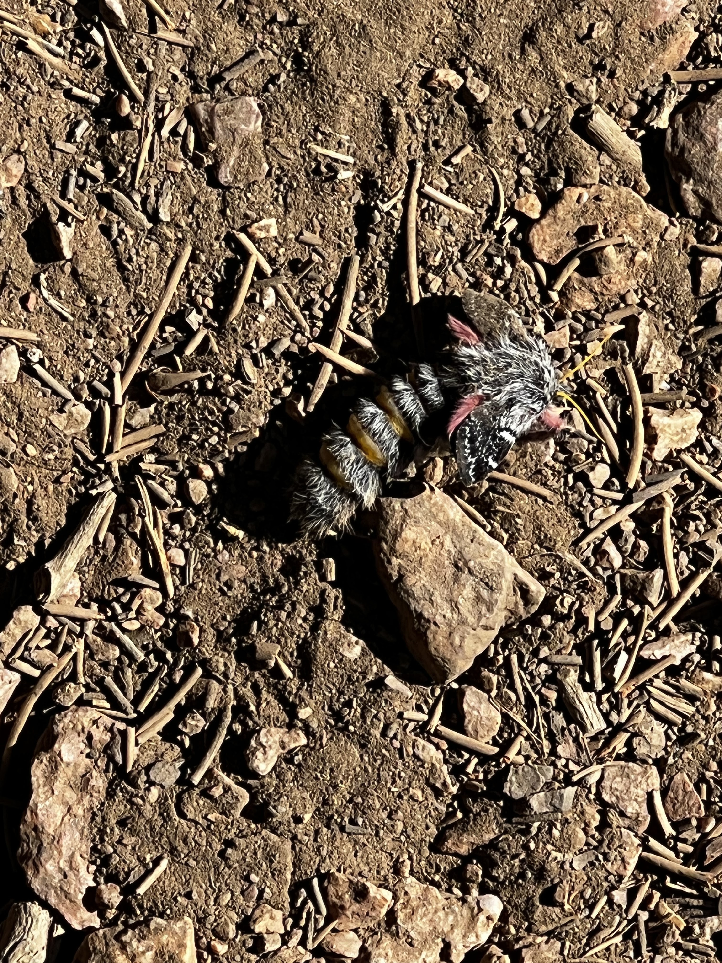
This looks like a caterpillar transforming into a moth, but not sure

Sorry animals using wheels, this trail is for animals using feet

Pretty nice trail today out of Big Bear

Wildflowers near Big Bear

Hummingbird food

A nice view of Big Bear Lake

Not a normal hiker lunch, but I think it’s nice to have a somewhat normal meal the first day out of town

Tentsite at Little Bear Spring Trail Camp, cooking dinner on my tiny, but powerful, stove

 
<--PREVIOUS                                                                                                                 NEXT-->

Thursday, May 26, 2022

PCT Day 14


<--PREVIOUS                                                                                                                 NEXT-->

PCT Day 14, 26 May 2022 (Thursday)

"Zero"


Start Location:

Big Bear Lake

Destination:

Big Bear Lake

PCT Miles Day 14:

0

Cum PCT Miles:

266.1

Non-PCT Miles Day 14:

0

Cum All Miles:

283.2

PCT Miles Remaining:

2,386.5


Elevation Gain Day 14:

0

Cum Elevation Gain:

48,042


Today Is what is called in long-distance hiking a zero day, a day were no miles are hiked on the official trail.  It is a day to get things done, and to let the body rest.  The good news is I actually got things done.  My cell service is working again, after only nine short days—maybe there’s a lawsuit against Verizon in the future.

I also got new pockets for my convertible Columbia pants (not sure why they used such cheap mesh fabric for their pockets).  Again, the trail provides here.  Nearing the end of the trail yesterday there was a board with various local business cards up there, and one happened to be for a seamstress who will do fast work for hikers.  She drove to the coin wash where I was doing laundry, picked up my pants, and then returned them about 1.5 hours later to my hotel.  She was only going to charge me $10, but I gave her more.

 
<--PREVIOUS                                                                                                                 NEXT-->

PCT Day 13


<--PREVIOUS                                                                                                                 NEXT-->

PCT Day 13, 25 May 2022 (Wednesday)

"Marathon"


Start Location:

Mission Creek Trail Camp

Destination:

Big Bear Lake

PCT Miles Day 13:

26.2

Cum PCT Miles:

266.1

Non-PCT Miles Day 13:

0.7

Cum All Miles:

283.2

PCT Miles Remaining:

2,386.5


Elevation Gain Day 13:

3,365

Cum Elevation Gain:

48,042


Today’s PCT miles were exactly 26.2, just a coincidence that it happened to be exactly marathon distance.  I have also now completed 10% of the trail.  There were ups and downs, like every day, but, overall, today had the easiest hiking, excluding the fact that it was 26.2 miles.  I am really looking forward to getting in to Big Bear today so I can, hopefully, get my cellular service issues squared away.  Also, I am looking forward to a shower, a regular bed, and a roof over my head.


The end of the day challenge was trying to get a ride from where the trail meets Highway 18 into the town of Big Bear Lake, about 8 miles away from my hotel.  Just like in Idyllwild, the trail provided.  Another hiker who was already waiting had called a local for a ride, and there was room for me.  I was the last stop for the driver, and the other hikers had already paid the driver enough money that he told me I didn’t need to pay anything.

Not many pics today, was just cranking the miles to get to town.

Coon Creek Cabin, an old building along the trail to Big Bear.

Big Bear Lake, in the distance, is the destination for today.

 
<--PREVIOUS                                                                                                                 NEXT-->

PCT Day 12


<--PREVIOUS                                                                                                                 NEXT-->

PCT Day 12, 24 May 2022 (Tuesday)

"Mission Impossible"


Start Location:

Whitewater Preserve

Destination:

Mission Creek Trail Camp

PCT Miles Day 12:

21.4

Cum PCT Miles:

239.9

Non-PCT Miles Day 12:

1.1

Cum All Miles:

256.3

PCT Miles Remaining:

2,412.7


Elevation Gain Day 12:

7,163

Cum Elevation Gain:

44,677


Today was a very interesting day that was both “fun“ and very difficult.  The majority of the day involved following and criss-crossing Mission Creek dozens of times while going steeply uphill.  Total mileage was over 22.5 miles (with side trails), and total elevation was almost 7,200 feet; this is pretty equivalent to the Cactus-to-Clouds hike from Palm Springs to the top of San Jacinto.  But, in several ways, today’s hike was harder.

First, the trail along Mission Creek has been wiped out multiple times by flash floods and it’s very difficult to follow in many parts.  Second, there is a lot of jungle-like growth along Mission Creek and getting through it involves a fair amount of bushwhacking.  Third, there may not be water available on the trail tomorrow so I had to fill up 7 liters of water at the last reliable source today, and carry it the last 1.5 miles to camp.  This last 1.5 miles is very steep and, sadly, involves several more challenging crossings of downed trees.  Not fun when you feel you are near the limits of your endurance and with a pack loaded down with a lot of water.

Today was another burner, everyone I saw on trail looked completely exhausted.  On the good side, it was nice to have water available almost all day long.  This meant only having to carry about 1 L of water instead of the normal 4-5 L that we had to carry during the hot, dry sections.  Also, we could soak ourselves in water all day long.  However, after completely soaking ourselves, it only took about 10 minutes for everything to get completely dry again.  Still, this temporary cooling really made the hike more manageable.

Lastly, at the end of the day, I ended up having a very nice and convenient camping spot; at least one bonus at the end of a long, hard day.  
After making it through the last two days, I feel like (I hope?) there is nothing I won't physically be able to handle the rest of this hike.


Landscape leaving Whitewater River area

San Gorgonio Mt.

Mission Creek, more life sustaining water in the desert

Is this the desert, or a jungle, or a rainforest?  We had to hike and route find today through a lot this stuff around Mission Creek
 
 
<--PREVIOUS                                                                                                                 NEXT-->

PCT End Of Hike Summary

<--PREVIOUS PCT End Of Hike Summary "A Summary Of My PCT Thru Section Hike"   This is the hardest post to write.  I could prob...