Friday, July 1, 2022

PCT Day 44

  <--PREVIOUS                                                                                                              NEXT--> 

PCT Day 44, 25 June 2022 (Saturday)

"Pinchot Me When It's Over"


Start Location:

Middle Rae Lake

Destination:

Wilderness Campsite

PCT Miles Day 44:

17.8

Cum PCT Miles:

811.3

Non-PCT Miles Day 44:

0.9

Cum All Miles:

878.5

PCT Miles Remaining:

1,841.3


Elevation Gain Day 44:

3,982

Cum Elevation Gain:

145,487


I got up later than usual this morning hoping that my tent would be mostly dry when I was ready to pack up.  However, it was not to be.  So, I packed up my wet tent knowing that I would have to dry it out a little later in the morning or in the day.

Today was a pretty spectacular water day.  There were many lakes, seasonal streams, incredibly scenic creeks, multiple snow patches, and water from the sky.  I have to say that Woods Creek is just about as spectacular as anything you’ll see in Yosemite.  But, you have to do a bit of backpacking to see it.

By the way, today’s weather was almost an exact repeat of yesterday.  Warm and clear until the early afternoon, then gathering of dark clouds, and eventually monsoon thunderstorms.  This is my third straight day of Sierra hiking when I have been rained or snowed on.  Today was a bit colder and windier though.  It feels more like late winter hiking than early summer hiking.  I guess this will prepare me for the state of Washington.  Luckily, it was not raining at my campsite.

I think all these monsoon storms have got the water levels rising a bit.  The creek crossings are still rock hops but there’s a few of them where you inevitably get your feet wet because of the higher water levels.

This is a section of the Sierra where you are going over at least one high pass a day.  Today’s pass was Pinchot Pass at 12,127 ft.  I thought this pass was much more strenuous than yesterdays Glen Pass.  It’s almost 8 straight miles of hiking uphill to get there.  It probably wouldn’t have been so difficult if I weren’t still carrying a lot of food weight.  I guess it’s hard to complain, though, when the scenery is so nice almost every step of the way.

I almost decided to wait until tomorrow to go up since the afternoon thunder clouds were starting to look ominous.  I passed some hikers that had decided to stop below the pass.  There is a real danger of lightning strikes on high passes.  I had to roughly calculate in my mind how fast I thought I could get to the top versus how long it might take for a thunderstorm to start.  Luckily, I got it right this time.

Oh yeah, I passed the 800 mile mark today.


Middle Rae Lake in the morning, where I camped last night

A nice Sierra Meadow by Arrowhead Lake

"Yard Sale" to dry out my tent

Suspension bridge over Woods Creek...it's very wobbly, so hang on tight and try to walk right in the center

Woods Creek Waterslide

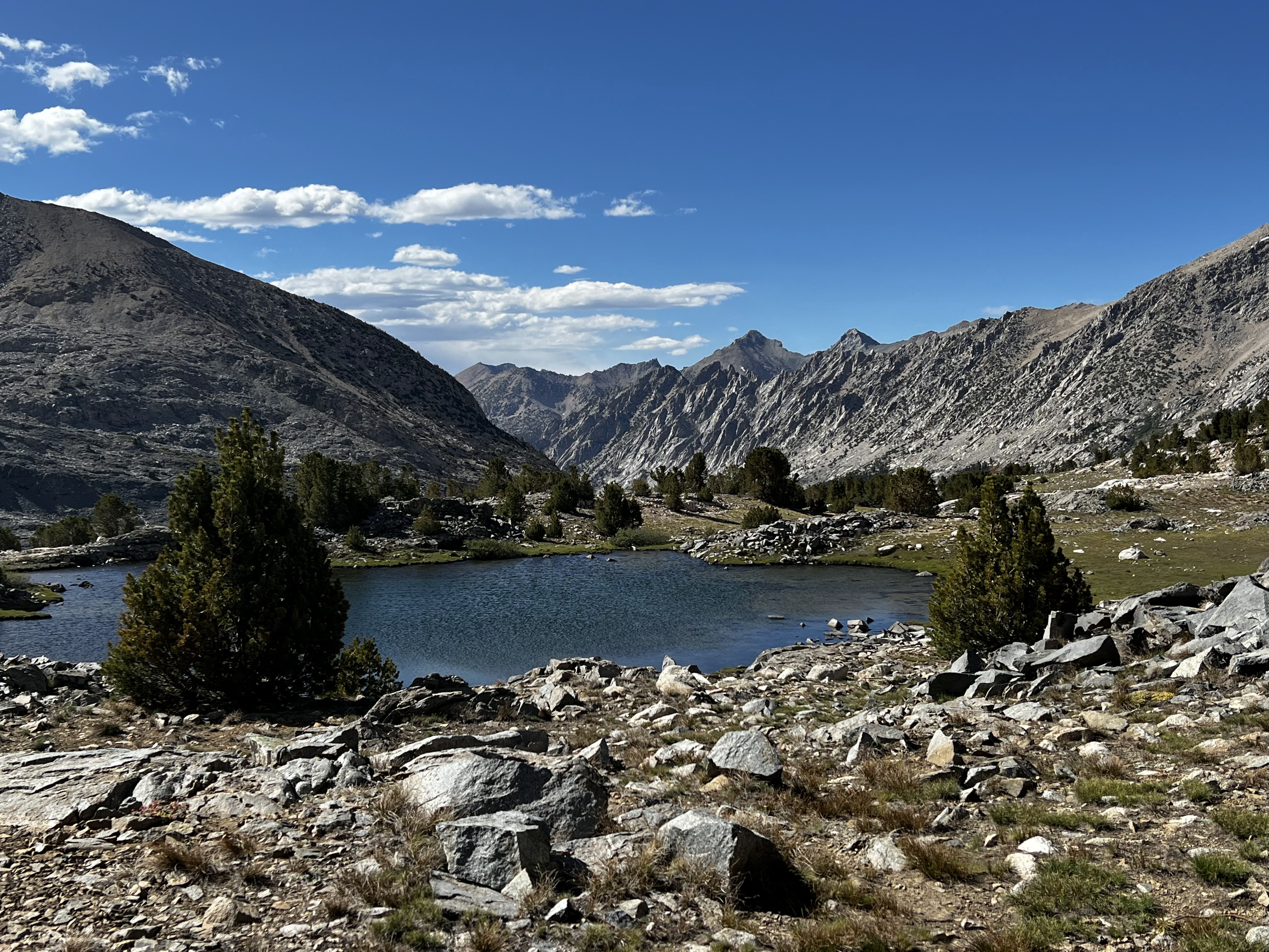
Ponds at the base of Pinchot Pass

Atop Pinchot Pass, no time to linger, the clouds are looking menacing.  Lake Marjorie in the background.

Hope of camping under blue skies while I hike in the rain

Campsite view, and blue sky, no rain
 
 
  <--PREVIOUS                                                                                                             NEXT--> 

PCT Day 43


 <--PREVIOUS                                                                                                             NEXT--> 

PCT Day 43, 24 June 2022 (Friday)

"Hard To Pass Up"


Start Location:

Independence

Destination:

Middle Rae Lake

PCT Miles Day 43:

4.5

Cum PCT Miles:

793.5

Non-PCT Miles Day 43:

8.0

Cum All Miles:

859.8

PCT Miles Remaining:

1,859.1


Elevation Gain Day 43:

1,509

Cum Elevation Gain:

141,505


Today was off to a good start, with the Mt. Williamson Motel serving a better than average motel breakfast.  Then several of us got on the shuttle at 8 AM to go back to Onion Valley Campground.  From there it was another good hike back up to Kearsarge Pass and then down to re-join the PCT.

Today’s stats don’t look very impressive, but the Kearsarge Pass Trail is a little over 7.5 miles and about 2,500 feet of elevation gain, but it doesn’t count since it’s a side trail and not the PCT.

The remainder of what I hiked today was, essentially, the approach to Glen Pass, going over the pass, and then down to Rae Lakes.

Glenn pass is, by reputation, the toughest pass to go over on the PCT/JMT.  However, while challenging, I don’t think it lives up to its reputation.  I think people perceive it’s tough because you have already done the somewhat taxing Kearsarge Pass earlier in the day, and most people are carrying 5 to 7 days worth of food.  So the food weight is very heavy, and this makes any hiking more challenging.  The views from Glen Pass, though, are very impressive with lakes everywhere you look.

This is monsoon season in the Sierra.  As I started going down Glen Pass, the clouds were starting to gather.  Soon after, it started lightly raining and then hailing.  It continued to rain for several hours.  These monsoon storms are not supposed to last that long, but this one just seemed to want to linger over where I was for an extended period of time.

I got my tent set up at Middle Rae Lake, so this will be the first real test of how waterproof my tent is.  This is the earliest I have ever got to a campsite.  I am trying not to get ahead on this stretch, so I arrive at Mammoth Lakes on schedule and not early.


 Looking down at the Onion Valley Campground

On the way up the Kearsarge Pass Trail from Onion Valley

Kearsarge Pass Again, this time with blue skies

Kearsarge Lakes on the way down from the pass

Charlotte Lake and Charlotte Dome (the interesting rock formation to the right)

Looking up towards Glen Pass

Icy blue tarn near the base of Glen Pass

From the top of Glen Pass looking north towards Rae Lakes

Atop Glen Pass, 11,957 ft., and no scraggly facial hair since I shaved in Bishop

Upper Rae Lake, Glen Pass is to the right of the cone-shaped peak

A stone bowl of water from today's monsoon storm

 
 <--PREVIOUS                                                                                                             NEXT--> 


Thursday, June 23, 2022

PCT Day 42

 <--PREVIOUS                                                                                                             NEXT--> 

PCT Day 42, 23 June 2022 (Thursday)

“A Trip Down The 395”


Start Location:

Bishop

Destination:

Independence

PCT Miles Day 42:

0.0

Cum PCT Miles:

789.0

Non-PCT Miles Day 42:

0

Cum All Miles:

847.3

PCT Miles Remaining:

1,863.6


Elevation Gain Day 42:

0

Cum Elevation Gain:

139,996


Today was a pretty relaxing zero day since I got a lot of stuff done yesterday in Bishop.  I got breakfast at the Pupfish Café, and a couple snacks at Great Basin Bakery.  Both are tucked away little places that are mostly frequented by locals.  Pupfish is a great place for breakfast or lunch if you’re ever in Bishop.  And Great Basin Bakery is, IMHO, better than Schats, if much smaller.


I watched some financial news on CNBC for the first time in about six weeks, and wished I was back out on the trail.


I caught the 1:15 PM Eastern Sierra Transit bus from Bishop to Independence, and that bus was completely filled up with other hikers.   I had a short walk down to the Mt. Williamson Motel, where I am staying tonight.  I am pleasantly surprised with the room I have.  This is also a very hiker friendly place.  Another place I would recommend to anyone passing through.  Also, I got my resupply bucket here.   I am now four for four in getting my resupply boxes/bucket.  This is the first resupply I did not send myself, so thanks for getting it here Mom.


Things definitely have a way of working out.  Since I was in Bishop yesterday, I got all my electronics all charged up, and my laundry done.  As you can see from the two photos I posted today, there are thunder clouds looming in the sky.  About an hour after I got to the motel, while I was organizing all my hiker food to get it to fit in the bear canister, there was a flash of lightning in the distance, and the power went out.


I’m sure all the hikers here who are going back to the trail tomorrow morning were freaking out a little bit about undone laundry, and uncharged electronics.  Although the power came back on about 90 minutes later, I was in good shape regardless.


Well, I guess that’s enough to say for a zero day.

Inyo County Courthouse with a large, donated lava rock that just happens to look like a piece of modern art


Mt. Wiliamson Motel And Basecamp

 
 <--PREVIOUS                                                                                                             NEXT-->    


Wednesday, June 22, 2022

PCT Day 41


<--PREVIOUS                                                                                                             NEXT--> 

PCT Day 41, 22 June 2022 (Wednesday)

“Weather Or Not”


Start Location:

Wilderness Campsite

Destination:

Bishop

PCT Miles Day 41:

0.1

Cum PCT Miles:

789.0

Non-PCT Miles Day 41:

7.6

Cum All Miles:

847.3

PCT Miles Remaining:

1,863.6


Elevation Gain Day 41:

0

Cum Elevation Gain:

139,996


Today was about as nero (near zero) as nero gets, with only 0.1 miles hiked on the PCT.  However, I did hike 7.6 miles over Kearsarge Pass to Onion Valley Campground, where I hoped to get a ride to either Independence or Bishop.  I am a day ahead of schedule, so I am planning on spending the night in Bishop, and then going back to Independence tomorrow.  Today is basically an unplanned town day.

There was a surprise this morning.  As I was packing up things inside my tent, I saw a white speck hit right outside my tent.  It was either hail or a very compact snowflake.  I’ve been out here over 40 days now, and this is the very first bit of precipitation.  I didn’t know whether it was a sign of a much larger storm or just morning moisture.

I decided the best thing to do would be to get packed up and hike as quickly as possible up and over Kearsarge Pass and down to the Onion Valley Campground.  I figured it would take me about 90 minutes to get to the top of the pass and about the same to get down to Onion Valley.  Since I am now low on food, I didn’t want to take the chance of being where I was in a much larger storm and being stuck there for more than a day.  I didn’t think there was a huge amount of risk in hiking through a snow storm for a couple of hours, even though part of it was going over a high pass.

As I started hiking, the sleet, hail, and snow started coming down more heavily.  However, it didn’t seem to be accumulating or sticking on the ground.  As I kept hiking, and gaining elevation, it started snowing even more heavily, and now it was sticking and accumulating.

I was concerned that if it started snowing very hard, the trail could be obscured.  However, I still thought there was more of a risk of not going forward than going forward.  It was a good decision.  As I got near the top of the pass, the snow lightened.  I was pretty motivated, and quickly made my way down the mountain.  Soon enough I was at Onion Valley.

My next challenge was getting a ride down the 13 mile road to either Independence or Bishop.  Onion Valley is a very busy trailhead. But I was there in the morning when the odds of getting a hitch down the road were much smaller than they would be later in the afternoon when people were finishing their day hikes.

After about half an hour, I saw a lady, Paula, running down the trail with her dog.  She saw me standing by the road with my pack and asked me if I needed a ride.  Of course I enthusiastically said yes.  It turns out, she was actually going right to Bishop.  So it was perfect.  She was a local and very knowledgeable about the outdoors and hiking.  The trail provides once again.


Bullfrog Lake from Kearsarge Pass Trail

 
New snow on the Kearsarge Pass Trail


Atop Kearsarge Pass

 
Interesting mosaic outside the Bishop Public Library


<--PREVIOUS                                                                                                             NEXT-->                             


PCT Day 40

 <--PREVIOUS                                                                                                             NEXT-->

PCT Day 40, 21 June 2022 (Tuesday)

“Apex Treader”


Start Location:

Crabtree Meadow

Destination:

Wilderness Campsite

PCT Miles Day 40:

22.6

Cum PCT Miles:

788.9

Non-PCT Miles Day 40:

2.4

Cum All Miles:

839.6

PCT Miles Remaining:

1,863.7


Elevation Gain Day 40:

5,445

Cum Elevation Gain:

139,996


What a 1-2 punch. First, Mount Whitney yesterday, then Forester Pass today.  The highest point I’ll get to on this hike, and the highest point on the PCT trail.

I have to say that whoever designed and built the trail leading up to Forester Pass, and especially going to the top of Forester Pass, did a great job.  When you’re near the base of the pass looking up, it doesn’t seem possible that there is a trail there, but there is actually a very good trail.

Today was another perfect weather day.  And the scenery was spectacular almost everywhere you looked.  It was the kind of day where you could take a great picture every few minutes.

I was going to spend the night at Charlotte Lake, which is not on the PCT, but decided to just get water there and find a spot back up by the PCT trail so I would have a shorter hike over Kearsarge Pass in the morning.  This decision was made much easier because of the fact that Charlotte Lake was also swarming with mosquitos, by far the most I've seen yet on this hike.

I am a day ahead of schedule again, so I’ll probably go to town a day early, but return to the trail on Friday as scheduled in my plan.


Morning scene, on the way from Crabtree Meadow to Wallace Creek


Wallace Creek, first longish water crossing...it was really just a long rock hop

 
Mt. Whitney from a different angle


Tawny Point, a little different look out here


Forester Pass ahead


Finally, a little patch of snow on trail


Getting closer to Forester Pass


Trail near the top of Forester Pass


Atop Forester Pass


Tarns at the base of Forester Pass

 
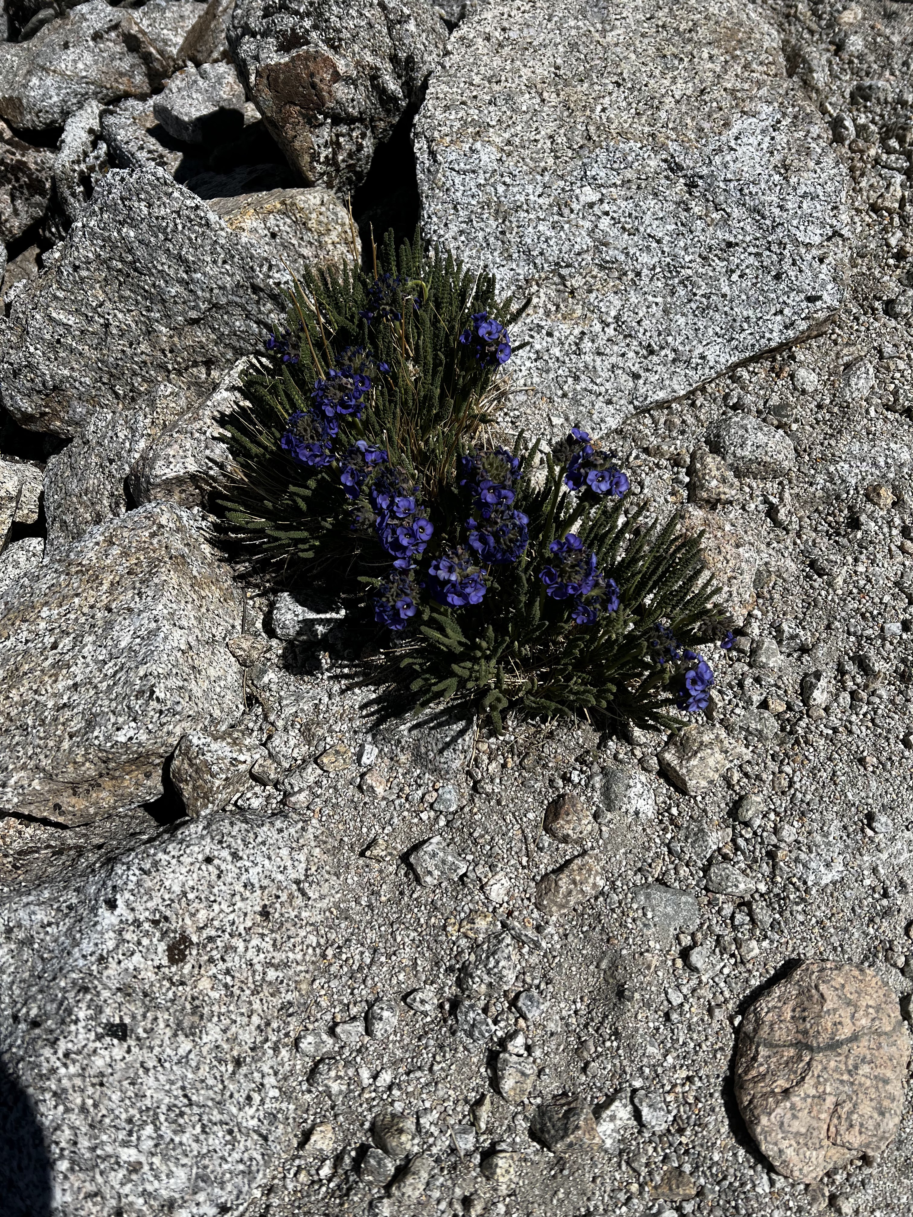
Skypilot. There is actually a geologic feature in Yosemite, Skypilot Col, named after this flower.


Unnamed pond...the photo doesn't do it justice, you could just sit there and look at it all day

 
East Vidette

 
Bubbs Creek

 
From near Vidette meadow

 
  <--PREVIOUS                                                                                                             NEXT-->