PCT Day 72, 23 July 2022 (Saturday)
"Coffee Break"
Start Location: |
Myrtle Flat, North of Belden |
Destination: |
Carter Creek |
|
PCT Miles Day 72: |
24.3 |
Cum PCT Miles: |
1,318.0 |
|
Non-PCT Miles Day 72: |
0.8 |
Cum All Miles: |
1412.0 |
|
PCT Miles Remaining: |
1,334.6 |
|
|
|
Elevation Gain Day 72: |
5,507 |
Cum Elevation Gain: |
235,447 |
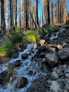
This is my fourth day hiking in the Dixie Fire burn area. Unless you see it for yourself, it’s hard to comprehend the scale and severity of these fire devastated wastelands. It sounds funny to say, but I think no one appreciates the scale of a fire like this more than PCT hikers. I doubt that even any firefighters walk the burn area from end to end (~150 trail miles). I don’t know what the timeline is for a landscape like this to recover to a point of even semi-resembling what it used to be, but it has to be at least a couple hundred years. It’s a weird juxtaposition to see so much clear, cold, running water in areas that are so burnt out.
I finished the long climb out of Belden this morning; another ~seven miles and 3,000 ft. One thing that won’t disappoint you about the PCT is that when you’re done with one climb, you don’t have to wait very long for the next one. Today was a lot of ups and downs.
There was a very nice break in the middle of the day, trail magic by Coffee and his girlfriend. The timing was good given all the up-and-down hiking through the burn area. Coffee was actually hiking the PCT this year, but had to get off in Yosemite due to plantar fasciitis. He lives in the area, so he knew where he set up would be a good spot. It was good stuff, eggs and bacon, fresh fruit, fresh vegetables, cold beverages, and more. Very nice!
The Sierran area that started north of Tehachapi, ended today near Chips Creek and transitions to the Cascade Range. That entire segment of the PCT is sometimes referred to as the Sierran Trail.

A nice, healthy seasonal creek amid the devastating backdrop.

Chips Creek with the new bridge. It must've been hard to get across this creek before the bridge was built.

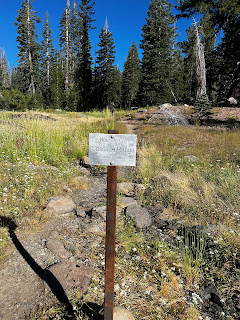
If going northbound, like me, you're starting the transition from the Sierra to the Cascade Range.

If going southbound, you are entering the Sierra.

First look at Lassen Peak

Trail magic by Coffee and his girlfriend (I guess I missed the memo that sun hoodies are the official uniform of PCT thru hikers).

Lake Almanor

Still on the right track


No comments:
Post a Comment