Friday, July 8, 2022

PCT Day 51

  <--PREVIOUS                                                                                                             NEXT--> 

PCT Day 51, 02 July 2022 (Saturday)

“Hikerphagia”


Start Location:

Mammoth Lakes

Destination:

Mammoth Lakes

PCT Miles Day 51:

0

Cum PCT Miles:

906.6

Non-PCT Miles Day 51:

0

Cum All Miles:

987.0

PCT Miles Remaining:

1,746.0


Elevation Gain Day 51:

0

Cum Elevation Gain:

162,406


Today is a zero day, and it was another productive day in Mammoth.  I do not have a resupply box for Mammoth, and I need to buy seven days worth of food. This is by far the most days I’ve needed to buy food for in town.  Because I ended up getting all the food at Vons, I had to get a little creative--interesting that Bishop has better options for hiking supplies than Mammoth.  I ended up with lots of food, so, hopefully, the hiker hunger I’ve been experiencing will not be as bad during this stretch of trail.


I was also able to backfill all of the elevation data into my blog, and I should be able to keep that up to date from here on out.  My next mini project for the blog is to try to backfill the side trail miles; this will be a little bit more challenging to do.


I also stuffed myself with town food all day long.  At one point, my mom said that she hadn’t seen me stop eating.  I replied, that I hadn’t stopped eating.  This is very common with long-distance hikers when they get to town, because you just can’t pack enough calories to match what you are burning on trail, especially on longer stretches like I have been doing lately.


This results in an intense desire to eat nonstop when food is available.  Since it’s been a while since I’ve made up a new word, I’m calling this “Hikerphagia.” Hyperphagia is when a bear is gorging itself nonstop just before hibernation.


For dinner, we went to Campo, an Italian restaurant in the Village.  We were joined by Kent, Emily had to take care of their dog.  Thanks Dennis for treating us all.  Of course, when we got back to the house, I finished off the second half of a pint of ice cream along with a cookie.  There might have been more food involved, but who remembers.


Another good zero day.  Thanks again to Dennis, Mom, Kent, and Emily for making the trip up to Mammoth.


Kent & Emily T., my brother Dennis, and my mom in the Village at Mammoth

 
      <--PREVIOUS                                                                                                             NEXT-->

Saturday, July 2, 2022

PCT Day 50

      <--PREVIOUS                                                                                                           NEXT--> 

PCT Day 50, 01 July 2022 (Friday)

"Mammoth"


Start Location:

Wilderness Campsite Between Purple and Duck Lake

Destination:

Mammoth Lakes

PCT Miles Day 50:

11.2

Cum PCT Miles:

906.6

Non-PCT Miles Day 50:

0.5

Cum All Miles:

987.0

PCT Miles Remaining:

1,746.0


Elevation Gain Day 50:

521

Cum Elevation Gain:

162,406


Today was a pretty easy cruise of just over 11 miles on mostly good, downhill trail to Reds Meadow.   The general store at Reds has a decent selection of items a hiker could resupply with if needed.   However, my plan was to go to Mammoth Lakes, so I caught the next shuttle bus down to the Main Lodge at Mammoth Mt.  From there I caught another shuttle to The Village.

This town stop is unusual for me, because there are several people up here to spend time with.  First, I met with Kent and Emily T., old work colleagues, and they are staying at The Village.  We had lunch together and chatted for a while.  Thanks for lunch Kent & Emily!  Meanwhile, my brother Dennis and my mom were on their way up.  We all met at The Village, and from there we drove to Dennis' house.  It's very nice to be able to have a place like this to stay for a couple of nights.  Of course, Dennis knows all the good places to eat up here, and we got food to go from Bleu Market & Kitchen, a really cool place with great food.  I'm jealous of their Toasted Pumpkin Seed bread, no matter how much bread I bake, I'm not sure I could ever make bread that good.  So a big thanks to Dennis and Mom!

Tomorrow will be a zero day in Mammoth and I'll be working on my next resupply and order my next pair of shoes to be delivered in South Lake Tahoe in ten days.

BTW, because Dennis has a computer at the house, I was able to get all my entries posted for the last week or so, and I have also added the elevation data for the entire hike.  So any stats geeks can take a look at that.


900 mile marker


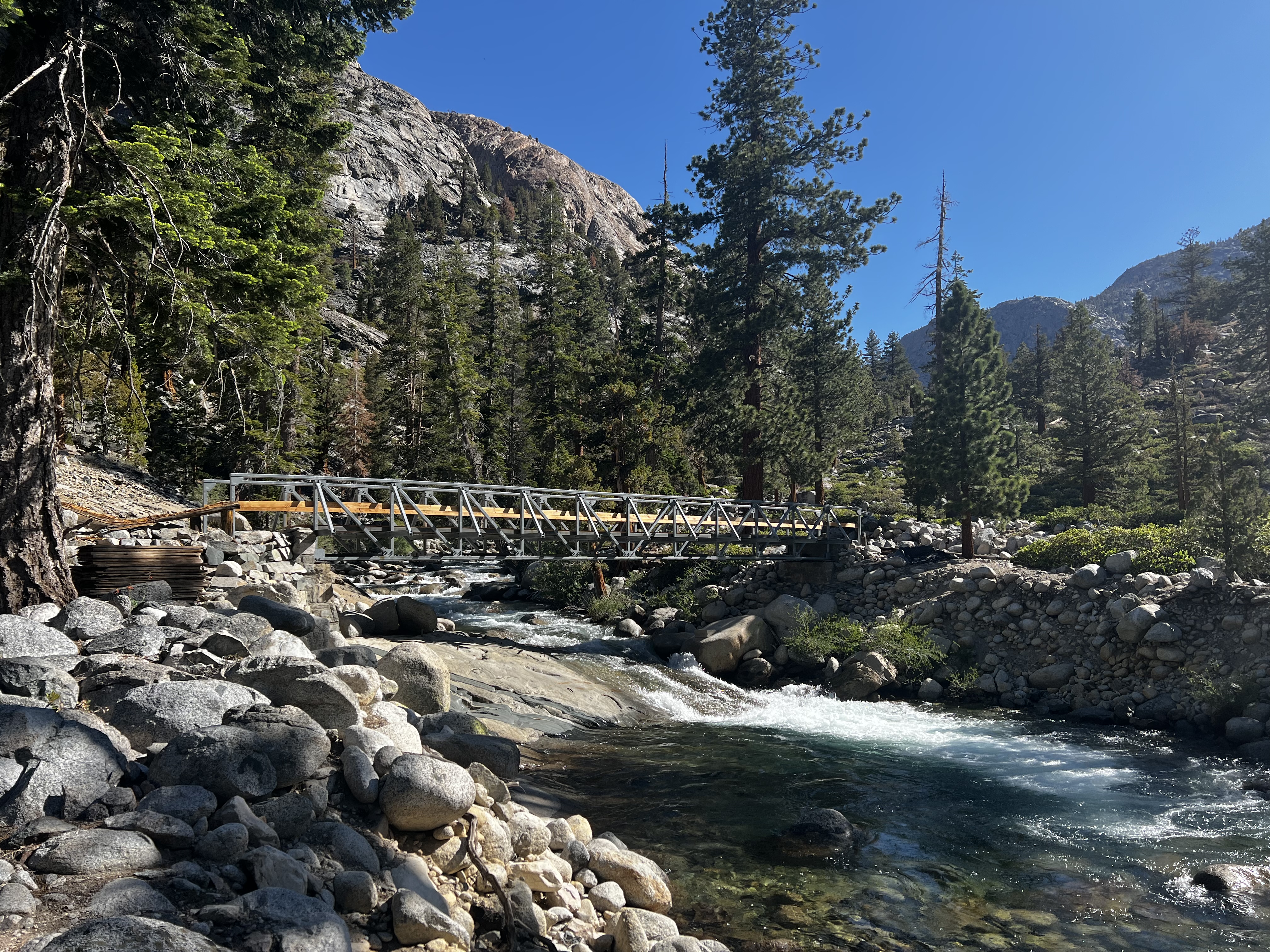
Crater Creek, a few miles from Red's Meadow

 
      <--PREVIOUS                                                                                                           NEXT-->


PCT Day 49

     <--PREVIOUS                                                                                                           NEXT--> 

PCT Day 49, 30 June 2022 (Thursday)

"Silver Fish"


Start Location:

Vermillion Valley Resort (VVR)

Destination:

Wilderness Campsite Between Purple and Duck Lake

PCT Miles Day 49:

16.7

Cum PCT Miles:

895.4

Non-PCT Miles Day 49:

2.3

Cum All Miles:

975.3

PCT Miles Remaining:

1,757.2


Elevation Gain Day 49:

5,181

Cum Elevation Gain:

161,885


Today got off to a good start with a huge breakfast at VVR.  Then I took a boat ride to the far east end of Lake Edison.  This meant having only a 2 mile side trail hike back to the PCT instead of 6.5 miles.

Today’s primary objective was, you guessed it, another high pass.  Today’s pass was Silver Pass at 10,778 ft.  Like Selden Pass, I wasn’t sure what to expect of this one.  But again, this pass did not disappoint.  It was a long, tough hike up, though, so the energy and time saved by taking the boat this morning was very important.

An unexpected highlight today was Fish Creek.  Like Woods Creek from a few days ago, this is a very scenic creek.  And like Woods Creek, I had no idea of what to expect, so it was a nice surprise.

I am now only about 11 miles from Mammoth.  And, I have now hiked over one third of the trail.


Cascading Silver Pass Creek

Atop Silver Pass, looking south

Atop Silver Pass, looking west

Some of the Minarets, Mt. Ritter and others

Chief Lake, below Silver Pass

Squaw Lake outlet, another nice rock hop

Fish Creek

More Fish Creek

A calm pool on Fish Creek before it starts plunging down hill

Lake Virginia, another very scenic lake

Purple Lake
 
     <--PREVIOUS                                                                                                             NEXT-->

Friday, July 1, 2022

PCT Day 48

     <--PREVIOUS                                                                                                           NEXT--> 

PCT Day 48, 29 June 2022 (Wednesday)

"On The Way To Lake Edison, A Light Bulb Switched On"


Start Location:

Wilderness Campsite Before VVR Trail Junction

Destination:

Vermillion Valley Resort (VVR)

PCT Miles Day 48:

6.5

Cum PCT Miles:

878.7

Non-PCT Miles Day 48:

8.5

Cum All Miles:

956.3

PCT Miles Remaining:

1,773.9


Elevation Gain Day 48:

970

Cum Elevation Gain:

156,704


Vermilion Valley Resort (VVR) is located at Lake Thomas A. Edison.  It’s a fairly large man-made lake located south of Mammoth Lakes and west of Round Valley.  It’s pretty popular with PCT and JMT hikers as they are very hiker friendly.

There are multiple options on how to get here, so you really have to think about what works best for you.  The Bear Ridge Trail is by far the most popular option, and is promoted by VVR as the best option, probably because it’s the fastest way for northbound hikers to get there.

However, it’s a 2,000 foot descent from the PCT down the Bear Ridge Trail to the resort; this is all on a side trail, meaning that to have a continuous footpath for a true thru hike, you have to go back up those same 2,000 feet over 5 miles to rejoin the PCT where you left it.

Alternately, you can travel another 4.2 miles down the PCT, which also includes the 2,000 foot decent.  Then it’s another 6.5 miles on the Lake Trail, also a side trail, to get to VVR.  But, this means you don’t have to go back up those 2,000 feet to get back to the PCT.  There is also the option to catch a ferry in the morning that eliminates much of the 6.5 mile hike back on the side trail.  Overall, going this way is a longer distance, but saves a lot of climbing back up hill.

When I got to the Bear Ridge Trail junction, I started going down, but then stopped to think whether that was really the best option.  After looking at the mileage and elevation profile, I decided going via the Lake Trail was really the better option.  It was like a light bulb going off.  Though it did take longer to get there, everything worked out great.  I got to VVR in plenty of time to do everything I wanted to do.

They are serving a BBQ meal here tonight, should be better than my normal hiker dinner.


BTW, as an indication of the dirt bag hiker I've become, when I got to VVR it'd been six days since I'd had a shower.   You can pay for a shower at VVR, but I thought naw, it's only two more days until I get to Mammoth.   If it's already been six days, what's two more days?


Seven Gables peak on the way to VVR
 
 
    <--PREVIOUS                                                                                                             NEXT--> 


PCT Day 47

     <--PREVIOUS                                                                                                          NEXT--> 

PCT Day 47, 28 June 2022 (Tuesday)

"Selden Seen"


Start Location:

Wilderness Campsite Past Evolution Creek

Destination:

Wilderness Campsite Before VVR Trail Junction

PCT Miles Day 47:

19.9

Cum PCT Miles:

872.2

Non-PCT Miles Day 47:

0.8

Cum All Miles:

941.3

PCT Miles Remaining:

1,780.4


Elevation Gain Day 47:

3,411

Cum Elevation Gain:

155,734


After the super spectacular scenery the last several days, it was hard to get excited about the scenery the first 12 miles today.  It was pleasant, but it just didn’t compare. But starting at Sallie Keyes Lake everything got much better.

There were three main things I had in mind today.  One, getting a fair number of miles in so I could get close to Vermillion Valley Resort (VVR); I plan on doing a mini resupply there, getting some fresh meals, and spending a night there.  Two, going over another high pass, Selden Pass.  And three, another significant creek crossing, Bear Creek.

I did get in almost 20 miles, which is good.  I could have gotten in a few more, but saw a good tent site by Bear Creek, so decided to stop at that point.

Selden Pass at 10,913 ft. is below tree level so it has a very different look than the passes that are about 1,000 feet or more higher.  I didn’t know what to expect of this pass, so I was pleasantly surprised.  It was just as scenic as the other high passes, but in its own way.  None of the high passes have disappointed yet.

As for Bear Creek, it was tamer than yesterday’s Evolution Creek.  The water was no more than knee-high and the current was not very strong, at least not where the crossing was.  Bear Creek, like Evolution Creek, can be dangerous to cross when water levels are high.  But right now, it’s a pretty simple crossing.


South Fork San Joaquin River in the morning

Piute Creek Bridge, the border of Kings Canyon N.P. and John Muir Wilderness

Sallie Keyes Lake

Outlet from Heart Lake on the way to Selden Pass

Selden Pass trail

Heart Lake from atop Selden Pass

Looking north from atop Selden Pass

Marie Lake

Bear Creek, second legs wet crossing

Bear Creek near sunset
 
  <--PREVIOUS                                                                                                             NEXT-->